Pages

Saturday, August 31, 2013

Craig Crest Trail Hike with Grandsons 8/31/13

My grandsons have become my favorite hiking partners.  They spent the night at our house and we got up early and headed to Grand Mesa.  This was Dylan's (youngest) first real hike - we discussed that this was a test if he was ready for hiking with us.  Ryan & Garrett had hiked with me several times before.  This is a 10 mile hike with about 1500 feet of elevation gain.  It would be a true test for him - we all we're hoping he'd do well.

There are two trailheads in case you only want to do half the hike and not the full 10 mile loop.  We parked at the Eggleston Lake trail head.  From left to right - Ryan, Dylan, Garrett.

It started out as a beautiful day - we watched picas, marmots, and played with camp-robber birds.  This is about 3/4 mile up the trail just above Little Eggleston Lake.


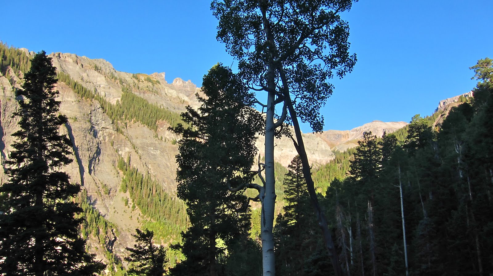
Another shot of all of them on up the trail as we begin the rocks.  The trail is not technical at all, but does go through lots of rocks.


At the top of the elevation gain, the trail goes up a spine of rock with breathtaking drop-offs on both sides.


We all love the movie Jeremiah Johnson.  We had to take what they called the Jeremiah Johnson shots on the cliffs.


Overview of Butts Lake (yes, that's its real name).  Wow what a day......though things were about to change.


Snack spot overlooking Butts Lake - lots of crackers and peanut butter, string cheese, jerky, candy bars.....it doesn't get any better.


But, as we were eating our snack I noticed a small pillar of a cloud off to the west.  The bottom of the cloud was almost at our elevation level.  This was not a good sign, as it was steadily growing.  (It reminded me of the story of Elijah on Mt. Carmel.  It hadn't rained for 3 years and he was praying for rain.  He sent is partner to look off the mountain several times - but no clouds.  Finally, one appeared that he described as the size of a man's hand.  Elijah said "it's going to pour - we'd better get off this mountain).  I told the boys that we might get wet before we got back to the car.  I explained that we could possibly hitch a ride back to the car from the trailhead at the end we were approaching.  In good-sport form they all agreed we should keep on going.


That cloud mushroomed and soon the sky opened up.  We donned our rain coats and tried to enjoy it as best as we could.  It rained on us for almost the entire 5 miles back to the car.  But, there was very little complaining.....we told stories and sang a song or two and made the best of it.


It was so much fun to see them enjoying themselves in God's great creation.  I do believe they have their grandpa's hiking genes!


On the way home they slept off and on.  When I thought they were all sawing logs, out of the blue Dylan spoke up and said, "grandpa, did I pass the test?"  I had no idea he still was thinking about that.  I said, "yes, you passed with flying colors!"  In fact you were like a rabbit up there - slow down and give me a break next time.  He's been hiking with us ever since.  He's been nicknamed Dylrabbit!

Tuesday, June 25, 2013

Ice Lakes Hike June 25, 2013

I had the great pleasure of hiking to the Ice Lakes with some good friends from New York City - Matt & Kim.  I met them a couple years ago on Youtube and have hiked with them the past two years.  They are great friends and great company on hikes.  I'd been to the Ice Lakes before and couldn't resist taking them there when they asked me to make a hike suggestion.  I drove up to their camping spot well before sunrise and we then drove the few miles to the trailhead and were off.  There was still great sunrise light on the peaks above.

Many water features are along this trail.  Matt & Kim posing by one of the waterfalls.


 More waterfalls!


Some mine remains.


Colorado Columbines - the state flower and also my favorite wildflower.  Golden Horn is in the center in the background.


 More streams and abundant Colorado blue sky!


Golden Horn - top center - it is very prominent behind Ice Lake.  The trail goes up under the large cliff in the picture center.


And still more streams!  Just a hundred miles east of here the largest fire in Colorado history was burning.  Hard to believe!


More flowers along the way providing relaxing beauty on a steady uphill grind.


And finally - Ice Lake - it was the most incredible blue that I've ever seen it.  These lake photos are not altered.  It was a mesmerizing blue.  I had the pleasure of being right at the spot where people would come over the hill and view the lake for the first time.  Lots of ooohs and ahhhs.  This hike is quite the tourist attraction; though many don't make it due to the altitude gain and distance.  Those that do; get a rare treat.  One young man from West Virginia told me; "I didn't even know such a color as that existed."  Needless to say; Matt & Kim were in awe as well.  No sights like this in New York City.


The blue of the lake and the Colorado sky made an incredible setting.  It was almost like a campfire - you just can't look away!


 The view back down the valley where we started.


The stream that feeds Ice Lake, surrounded by Parry's Primrose and Marsh Marigolds.  Golden Horn towering in the background.


Acres of wildflowers.....as if the lake itself wasn't enough reward for the hike.


Looking back east - cumulus clouds of smoke from the wildfire.


It was a splendid day - one that will be treasured in the memory halls forever.  Thank you Lord!

Saturday, September 8, 2012

Weehawken Basin to Mt. Ridgway September 8, 2012

"Climb the mountains and get their good tidings.  Nature's peace will flow into you as sunshine flows into trees.  The winds will blow their own freshness into you, and the storms their energy, while cares will drop like autumn leaves."  John Muir

The last post on Sneffels Overlook reminded me of a fantastic hike I made up Weehawken Basin to the summit of Mt. Ridgway.  Mt. Ridgway is a 13'er (over 13,000 feet high).  It's just above Blaine Basin and just east of Mt. Sneffels.  It's about a 12 mile hike round trip with around 4,600 feet of elevation gain.  So, it's a "puffer" for sure.  I did not realize that I was doing this hike on the same day as the annual Imogene Pass Run from Ouray to Telluride.  I noticed lots of barricades, etc but didn't know for sure what was happening.  They closed the road for most of the day after I had gone on up the basin.  Fortunately, it was all over and the road reopened by the time I got back to my pickup.


Trail head.


There were still quite a few wild flowers.


The trail gains altitude fairly quickly and then opens up a bit for some nice views.  Mt. Ridgway is way up there at the end of the valley.


There are lots of cool hoodoos along this trail.  There are also many cuts from streams that come into the main creek.  Though most were dry, they were often tricky to cross due to washing out during heavy rain storms.


More hoodoos!


Wow, it's getting really cool now.  The valley narrows just before entering Weehawken Basin.


The view back down the valley at the beginning of Weehawken Basin.  There is no trail here that I could find.  There was very little evidence that this area is used much at all.  I was the only one on the trail this whole day.


Weehawken Basin.  Potosi Peak is top center and a very nice rock glacier at its feet.


Mt. Ridgway front and center.  Whew, still a long ways to go.


Mt. Ridgway is high on the left.  Whitehouse Mountain on the right.  Just left of the knob in the center is the way up through the slide area.  I was on all 4 going up that.  But, I've been on worse.


Now we're talking!  This is on the ridge just left of the knob in the photo above.  The view off the other side to the north is fantastic.  Mt. Ridgway's shoulder is on the left in this photo.  Still a bunch of up to go.  But, when you get to this point the views are sooo good that sweat and work is well worth it.


Lots of loose talus from here on.  It was non-stop work.  Forward two steps slide back one.  Montrose, CO is upper left in this photo.


Yes, finally the summit.  That's Mt. Sneffels in the center.  Blaine Basin is below.


The summit cairn.  Whitehouse Mountain in the background.


These San Juan mountains are gnarly!  Potosi Peak is upper left, Teakettle Peak is upper right.


Sneffels (14,157') is a beauty!  I was up there years ago.  I feel the yearning to go back.


On the way back down, there was a light show in Weehawken Basin.  I don't care how many times you visit these mountains, there's always a new view and hope that tomorrow will be even better than today!  But, I wonder if it can get any better than this.


More incredible beauty!


One last view across Yankee Boy before dropping down to the trailhead.  More memories, and more reasons for thanksgiving to our awesome creator God!