Pages

Saturday, July 25, 2015

High Mesa to the Top Of The World! 7.25.15

On this day I had the rare treat to have my wife Joann join me on a hike.  I promised that this one was fairly flat and the views would be worth any effort expended.  She doesn't always believe me when I say that though.  Maybe it's our varied definitions of "fairly flat".  But, this one is really fairly flat.  It begins at the very end of the High Mesa Road.  The trail follows an old logging road for about 3 miles where it crosses a motorcycle trail up over High Mesa.  It's easiest to then follow the MC trail out to the edge of the mountain and turn left (south) and then hike on up to the high point - that's the Top of the World.  That last hitch is fairly straight up, but it's not far.  The views are stunning, as you'll soon see.


Panorama from Top of the World.  Views of Silverjack Reservoir, Cimarron West Fork, Middle Fork ,and East Fork.  Heaven just has to be only a stone's throw away!


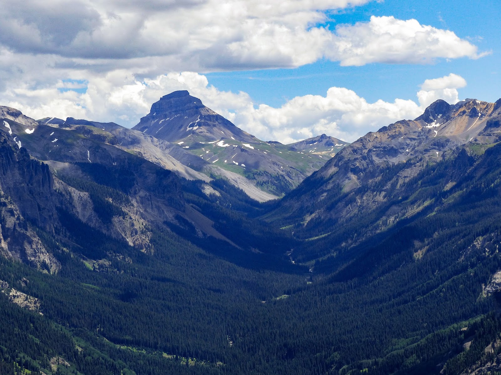
View up the Cimarron East Fork.  That's Uncompahgre Peak at the end of the valley - I've been to the foot of it on a couple sides.  I need to get up there!  It's the highest point in the San Juan Mountains.


Trees don't last long up here, there's just too much wind.  But, on this day it was unusually pleasant, only a breeze.


Some old mountain goat.


The west side of Sheep Mountain is gnarly!  I'd love to see how that was created.


Shrooms - I doubt they are edible.  Joann thought they were "cute".


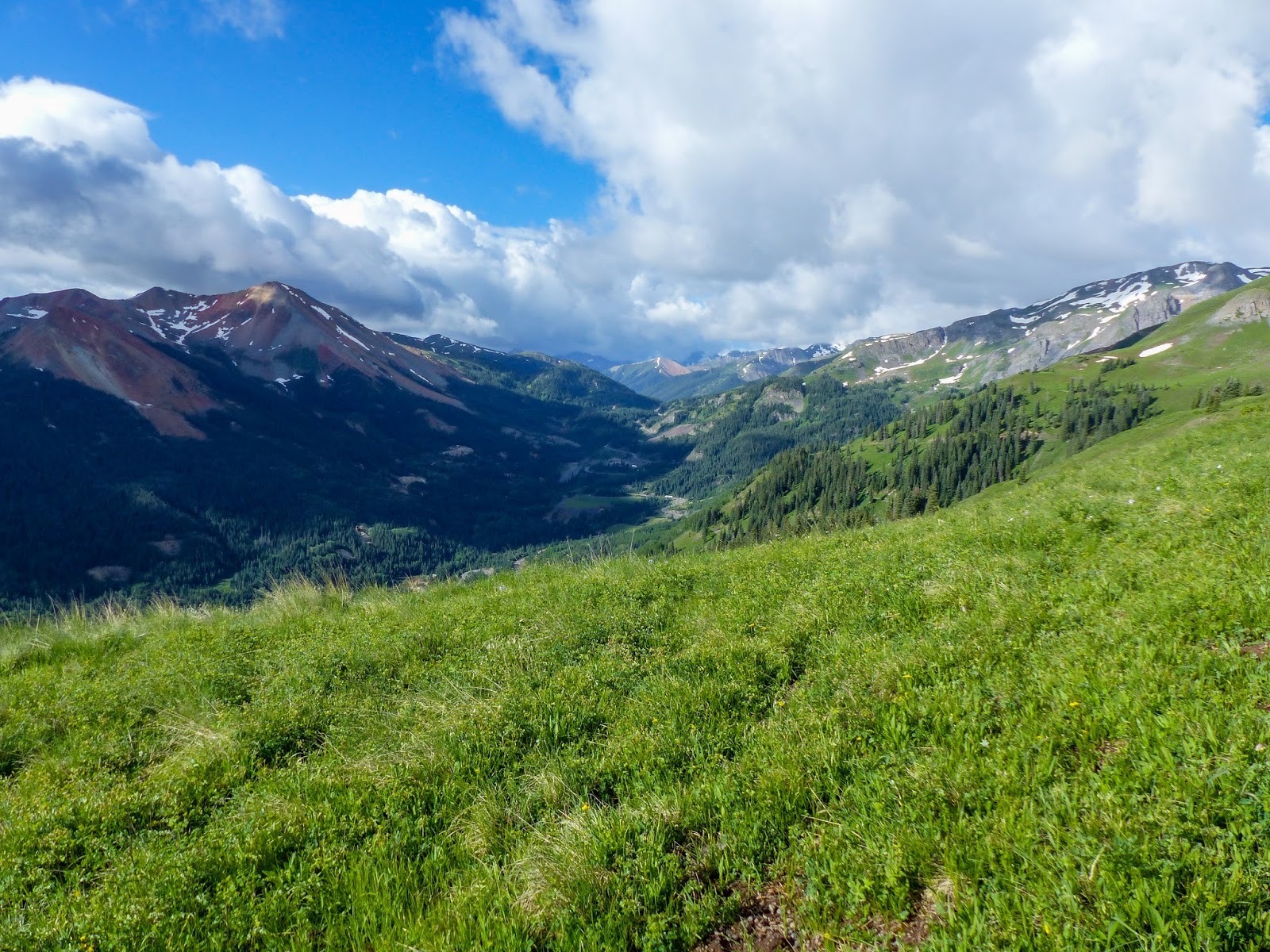
Trees, trees, and more trees - some extremely tall for this country!  What fun to watch them sway in the breeze.


I wonder what a moose was doing up this high?  She probably was avoiding the "city" below in the Silverjack area and the Little Cimarron.  From above, it literally looked like a city of campers, motorhomes, etc.  I'm glad I was up here too - above that mess.


View of Sheep Mountain just after leaving the trail head.  This is why I hike.  These views are tucked away all over these San Juan mountains.


Looking down on Silverjack Reservoir and the city of campers.


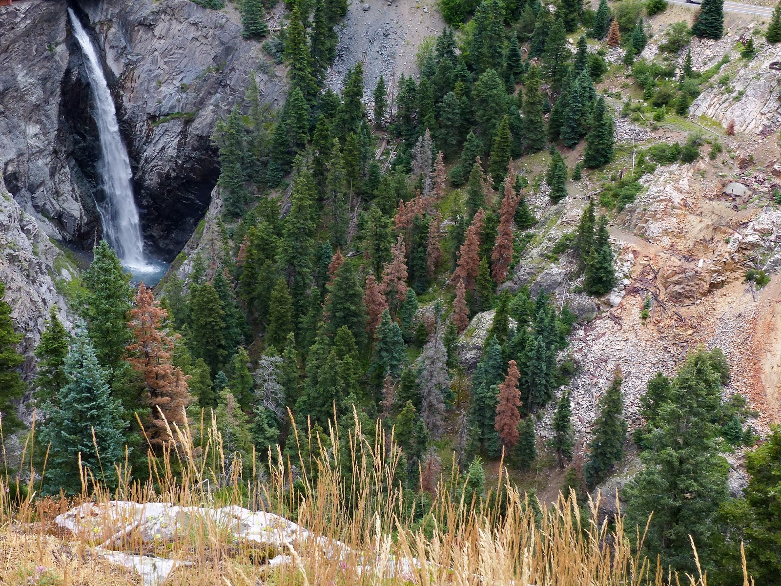
View up the Cimarron East fork.  The middle fork is in the far right of the picture.  The brown area in the lower left is the East Fork fire site from a couple years ago.


Gopro camera setup taking a timelapse.  


Lady on a Rock (Joann) - upper right.  The Sneffels Range is in the far background, above and beyond Owl Creek Pass.


Cottontail rabbits were all over the road on the way out.  I don't know what attracted them to the road, but we'd come around a corner and see 8 or 10 of them out on the road.  What a wonderful day in God's great outdoors with the love of my life!

Saturday, July 18, 2015

Sutton Mine Hike - A Race Against Rain 7/18/2015

I just needed to hike on this day, and hoped the predicted rain would not stop me.  I picked a quick, easy trail to scratch my hiking itch.  I was also using a new camera (Panasonic FZ200), which I ended up returning.  Lugging the heavy DSLR gear is not always what I want to do when going light and fast.


Yep, that's the trailhead.  This was also the weekend for the Toyota FJ Cruiser Summit.  Their website said there were 341 vehicles and 923 people attending this year's event.  I think all 341 of them passed me as I was unloading and donning my backpack.  I was surrounded in a cloud of dust.  But, it was fun to see all the modifications and colors of FJ Cruisers.


Everything looks good so far.  Blue sky, sunshine.  But, the ole weather grump says that will change. So, I'd better get moving just in case he's right.....again.  He's been pretty accurate with all his rain predictions this summer.  Lots of purple asters all along the trail.


Asters a-plenty!


Even a few sego lilies.


View back down on Ouray from the overlook.


Mt. Abrams up the valley.


The trail was lush from the summer rains.  The weather still looks good - maybe ole weather-dude made a mistake!


In fact, at spots the trail was so overgrown it was like walking through a jungle.  I'm not complaining, it's far better than drought.

This is a boggy area the trail goes around.  A couple years ago when I was up here I did not see any dead trees.  The pine beetles are wreaking their havoc.  By the way, those gray clouds are looking more threatening.


This is the tallest paintbrush I've ever come across.  It was about 3 feet tall.

This squirrel got all twitterpated at me.  It was only about 10 feet above my head and made so much racket that I wondered how he took a breath.


View across the Uncompahgre River gorge to Bear Creek Falls.  Some day I'm going to hike down there.


If you've ever driven on Hwy 550 over Red Mountain and seen a building across the gorge with laundry on the line - this is it.  I used to think somebody lived over there and they must be dirty people as they are always drying laundry on the line.  It's actually one of the mine buildings and it has become tradition for hikers to leave pieces of clothing hanging on the line.  I didn't have any to spare today!


Mine building interior.  If only those walls could talk.  I'd like to hear some stories about days gone by.


Another mine building.


Bloomers???  There's another story there I'm sure - maybe I don't want to know this one.  Some old photos on the wall give clues to stories better left untold.


An ore car hanging on the edge.  Highway 550 is in the background.  Just left and slightly below the ore car is the parking area for the Bear Creek Falls overlook.


It looks like ole "weather dude" was right.  Time to make a beeline back to the trailhead.  It started to sprinkle when I was getting close to the end.  As I reached my pickup I hurriedly tossed in my backpack and just as I shut the door there was an explosion of thunder and the sky literally opened up in a deluge.  It was a major downpour all the way to Ridgway.  I'm glad I made it back when I did.  Thanks Lord for another great - though short - hike!

Saturday, July 11, 2015

Richmond Pass 7.11.15

The grandkids spent the night so the hiking crew could get up early and try to beat the thunderstorms.  I shook them out of bed about 5am and we were hiking at about 6:30.  We're missing one of the "brothers" as he had a birthday party to attend to.  So, it was just me, Garrett and Ryan headed up the Richmond Pass trail.  This trail takes off very close to the highway over Red Mountain Pass.  If you don't know where it is, then you'll likely miss it as the trail sign is back in the trees.  After heading south through Ironton Park, be ready for a 45 mph speed limit sign - the road turnoff is just before it.  There's a very small parking area up in the trees about 75 yards.  This trail is elk heaven.  I have another post of this trail earlier on the blog.  Both times I've encountered elk in abundance.  I wanted the grandsons to share in that so away we went!

Posing at the trailhead - Garrett & Ryan


The day started out beautiful.  Lupine in abundance and sunshine.....that was soon to change!


Looking back over the valley to the Red Mountains.


A fantastic morning - great to be alive and able to get into the mountains and let the mountains get into us.


More of the Red Mountains - appropriately named I might add!


Uh Oh - a view to the southwest shows thunderheads building.  Our storms up here generally come from the southwest.  We'd better get moving.  Being above timberline when these things roll in is not pleasant nor smart!


Wow, it just doesn't get any better than this.  Why the Lord would bless me this much is beyond me!


First elk spotting - a cow off by herself.  She gave us the eye and then roamed over to join the rest of the crowd.


We were high above the herd.  They didn't even know we were around.  They were not disturbed at all, which is just how I like it.  There were probably 50-60 elk in this group.


Mr. Bumblebee enjoying an alpine sunflower...oblivious to the impending storm.


Three mule deer bucks were lounging way above timberline.  They too did not seem to care that a storm was coming.


We'd just barely taken the buck photos above when the rumble began.  We could see the storm approaching up the valley in a hurry.  We hustled as fast as we could, often nearing a run to get back to tree line.  Just as we got there it opened up and did some rumbling.  We got a bit wet, but not bad.  It rained most of the way to the car.  But, when we got there and began eating lunch, the sun came out.  However, it was short-lived as the storms just kept rolling in.  We still had a great hike, even though it was short.  Just a few minutes in God's outdoors is better than hours anywhere else!